Nor’easter to Bring Heavy Wet Snow, Rain, Gusty Winds to Seacoast
❄ A mix of snow and rain will turn to all snow by Tuesday morning
❄ The snow will be heavy and wet, which could bring down trees and power lines
❄ A change in the track could change the forecast
The likely last nor'easter of the winter will bring both rain and heavy snow to the Seacoast region Monday night and all day Tuesday.
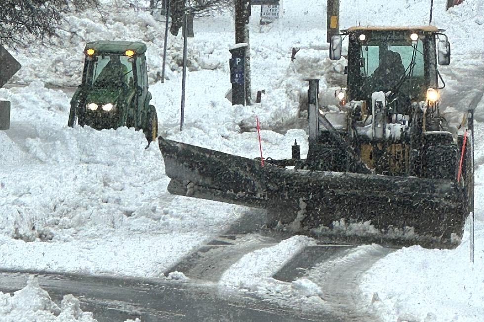
The storm will begin as a mix of rain and snow Monday night and continue all night. It will transition to all snow by Tuesday morning's commute, and continue all day Tuesday into the early morning hours of Wednesday. The heaviest rate of snowfall will be during the Tuesday morning commute.
A Winter Storm Watch is in effect for southern New Hampshire and Maine and all of Massachusetts late Monday night through Wednesday afternoon.
"Once it starts snowing, it's going to be a very heavy, wet snow," meteorologist Stephen Baron at the National Weather Service in Gray, Maine told Seacoast Current.
The track of the storm holds the key.
The track of the storm has not yet locked in, which is key to the snow amounts.
"With any kind of storm like this, there's always a lot of track uncertainty even right up until 24 hours before the event. As usual, that rain/snow line is going to be the biggest question mark. That's huge when you're talking about the total accumulations," Baron said.
Baron expects a total storm accumulation of 6-8 inches for coastal areas, but interior Rockingham and Strafford counties can expect 8-12 inches.
A more western track would favor more rain than snow, but if the track takes the storm east, which happens in some model runs, then you get more snow for the Seacoast.
The wet snow could also bring down trees, branches, and power lines, creating widespread power outages, according to Baron.

Gusty Winds
Contributing to the risk of power outages is a prolonged period of winds gusting onshore out of the northeast at 50 mph along the coast and 35-40 mph inland, according to Baron.
"Luckily though, the tides are not too high. They're not astronomical" Baron said. "It would likely just be a minor surge because of the 12 hours of onshore gusty wind we're going to have."
Eversource said it is monitoring the forecast and prepositioning equipment and line and tree crews at its work centers around the state.
"The hazardous conditions can also make travel challenging for our crews, so we’re staging extra staff and equipment in our work centers across the state to ensure we’re ready to respond as quickly as possible to whatever this storm brings," Eversource New Hampshire President of Electric Operations Doug Foley said in a statement.
The storm could represent winter's true last gasp.
"It's March. The sun angle is increasing, day length is getting longer, and average temperatures continue to climb," Townsquare Chief Meteorologist Dan Zarrow said. "My observation and my mantra is that 'big' snow storms are very rare past the Vernal Equinox, the official start of spring. That is coming up on March 20, only eight days away."
Zarrow said long range models do not include any substantial winter storms on the horizon for the next week or two.
Contact reporter Dan Alexander at Dan.Alexander@townsquaremedia.com or via Twitter @DanAlexanderNH
The Weather Is Bad Outside if One of These 20 Places in Maine are Closed
Gallery Credit: Chantel
More From Seacoast Current