Two Rounds of Winter for the Seacoast: One Down, One to Go
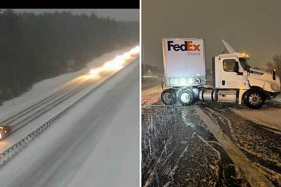
Heavy snow overnight that mixed with sleet and freezing rain left an icy coating on the Seacoast for the Thursday morning commute, with another storm on the way.
Snow accumulated 3-5 inches during the early morning hours of Thursday from the first of two storms to affect the Seacoast. The wintry mix of precipitation will continue through late morning and then taper off. The storm also leaves a half inch of sleet and a light glaze of ice.
A Winter Weather Advisory and Winter Storm Warning are in effect in the Seacoast until 1 p.m. Thursday.
New Hampshire State Police said they responded to 30 vehicles off the road between 11 p.m. Wednesday night and 6 a.m. Thursday morning statewide, and urged drivers to reduce speeds and leave extra space for the vehicle in front.
COAST buses curtailed operations Thursday due to the poor road conditions.
The outage maps for UNITIL, Eversource, Liberty, New Hampshire Electric Co-op and Central Maine Power were showing minimal outages as of 8:15 a.m.
Some Seacoast school districts canceled classes for the day, but some districts like Exeter and Epping declared a remote learning day that kept students home for the day, but expected to participate in classes from home.

The next round of winter weather arrives Thursday night with a similar wintry mix that will be lighter, with an accumulation of 2-4 inches expected.
Behind the second storm will be much colder air with gusty northwest winds Friday and Saturday. Wind chills will be in the single digits or teens, despite air temps in the 20s.
Contact reporter Dan Alexander at Dan.Alexander@townsquaremedia.com or via Twitter @DanAlexanderNH
Let's Do Some 80s & 90s New England Channel Surfing
Gallery Credit: Jon Rineman
More From Seacoast Current