Cold Front Could Bring Heavy Rain, Gusty Winds to Seacoast Wednesday
Thunderstorms could roll through on the Seacoast during Wednesday's commute. o
Forecasters at the National Weather Service in Gray, Maine, said that a humid air mass will be in place Wednesday thanks to a warm front that came in on Tuesday night bringing humidity back to the Seacoast. After a foggy start, Wednesday will become sunny with temperatures in the 80s.
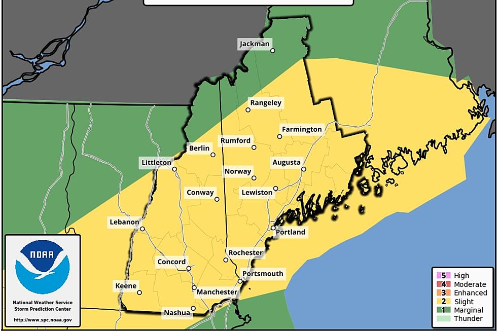
The taste of summer will last for just an afternoon as a cold front slides from northwest to southeast across northern New England and creating ideal conditions for possible damaging winds, heavy rain, tornadoes and hail after 3 p.m.
Wednesday will also be the last day of a smokey haze in the atmosphere again from the still burning western wildfires. The should not have an impact on air quality.
Once the front passes it will stall to the south locking in clouds on Thursday and Friday with high temperatures in the 70s. Skies will start to clear on Saturday and temperatures will be in the upper 70s into Sunday.
This report was updated at 7:50 a.m. Wednesday morning
Contact reporter Dan Alexander at Dan.Alexander@townsquaremedia.com or via Twitter @DanAlexanderNJ
Thunder Over NH Air Show
Gallery Credit: Dan Alexander
More From Seacoast Current