Ida Brings Rain, Wind to the Seacoast Into Thursday
The remnants of Tropical Storm Ida will affect the Seacoast for 12-18 hours as the storm slides to the east on Wednesday night.
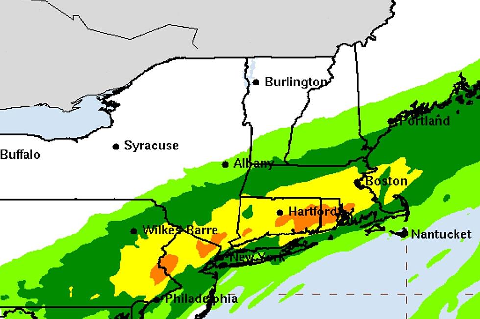
Meteorologists at the National Weather Service in Gray, Maine expect have settled on a more southerly track with rain starting Wednesday evening and lasting until late Thursday morning. Rain will gradually spread northeastward tonight with periods of moderate to heavy rain expected across southern New Hampshire and coastal Maine
1-3 inches of rain are expected to fall before ending west to east by Thursday afternoon. Because the precipitation will fall over an extended period major flooding is not expected. The rain will be heavier to the south with 3-5 inches possible in Essex County.
A Flash Flood Watch is in effect from midnight early Thursday until the afternoon for possible flooding along smaller rivers and streams and in poor drainage areas.
As Ida turns north towards the Gulf of Maine on Thursday it will resemble a nor'easter with 3-6 foot waves along the coast and winds 20-30 knots gusting to 40 right along the coast where a Gale Warning is in effect, according to the Grey office.
The Calm After the Storm
Once Ida heads further north the long Labor Day weekend looks nice with sunny skies through Monday.
High temperatures will be around 70 on Friday but warming up into the 70s on Saturday and Sunday. High temperatures on Monday should be around 80.
Contact reporter Dan Alexander at Dan.Alexander@townsquaremedia.com or via Twitter @DanAlexanderNH
LOOK: The most expensive weather and climate disasters in recent decades
Gallery Credit: KATELYN LEBOFF
More From Seacoast Current


